Meelup Recovery
Update - 25.03.2022
Meelup Regional Park is still recovering after the January fires with approximately 190 hectares, or 40% of the park being burnt in this one fire.
The line between burnt and unburnt is a 1m wide coastal trail just east of Castle Bay. Luckily a thin strip of vegetation along the coast did not burn. It provides refuge for fauna that escaped the fire while vegetation within the fire ground recovers.
Already there’s signs of recovery. The Balgas have put on new leaf and the trees and shrubs are growing new shoots. Slowly the canopy of the trees will turn from brown to green.
Please just remember to stay on established trails when walking in the park.
Update - 16.02.2022
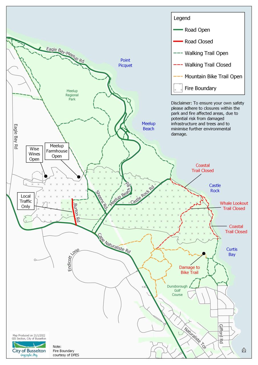
The Coastal Trail has been opened (refer to the map below).
We ask that people stick to the coastal trail and existing tracks to the coast - please don't venture off the coastal path. The vegetation is in an extremely fragile state and needs to be given time to regenerate. The Whale Lookout Trail is still closed. All fire containment lines are closed.

Update - 21.01.2022
Meelup Regional Park and some of the surrounding areas are still closed and are fire affected. Please adhere to closures due to potential safety risk from damaged infrastructure and trees and to minimise further environmental damage.
As of 20 January 2022, Castle Rock Road is now open, although the walking trails are closed.
Rural Aid Australia is a not for profit organisation and is offering free fence damage, property damage and winery damage to properties effected by the Meelup bushfire. Rural Aid Australia can be contacted on 0460 310 661 or email Rodger.hitchcock@ruralaid.org.au
For a full view of road closures and walk trails, please refer to the below map or you can download it via the link.
Download the Meelup Regional Park Closure Map - 21.01.2022
Update - 14.01.2022
Meelup Regional Park is an iconic area containing significant environmental, landscape, social and cultural values. 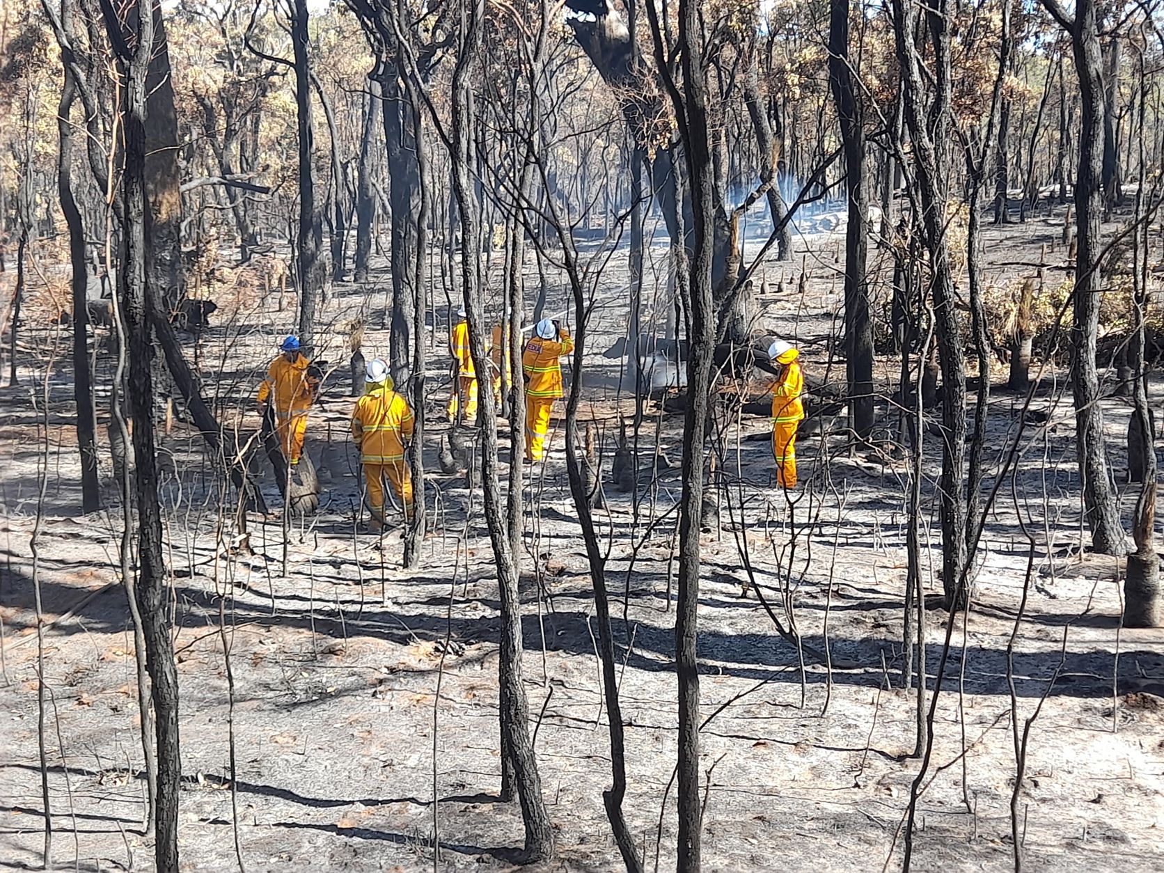
With Meelup Park and some of the surrounding areas being an active fire zone, large portions of the park are closed to the public from a safety and environmental perspective.
The timing of when the park will be open is unknown at this point, however, updates will be provided regularly.
We seek the public’s cooperation by avoiding the area and adhering to any road or trail closures. This for your safety and to minimise any further damage to the park.
We can confirm that the following roads will be open from 4pm Friday 14 January 2022 (see map below):
- Meelup Beach Road
- Sheens Road
We ask that all vehicles reduce their speed limit in accordance with the speed signage and that you remain in your vehicle at all times (please don't pull over on the side of the road for photos).
All walk trails remain closed.
The City is working in partnership with the Meelup Regional Park Committee and other stakeholders to ensure the best possible recovery of the burn area.
The City is currently assessing the impacts of the fire including damage to infrastructure, trail signage and to environmental/cultural values.
The City is undertaking post-burn actions to ensure that the significant natural values of the Park are protected. This includes:
- FAWNA Wildlife carers are undertaking fauna checks in the burn area
- Consultation with the Department of Biodiversity, Conservation and Attractions (DBCA) on management measures to monitor and protect conservation values
- Feral animal and weed control management.
- Trails will be assessed and may require access management including temporary fencing to allow natural regeneration of vegetation and recovery of habitats.
We will continue to keep you informed of post- burn planning works and when the Park will be open again to the community.